A new study reconstructing 4,000 years of Majuli's climate history offers crucial insights into flood security, erosion management and climate adaptation in Assam.
New Delhi, June 1: A new scientific study reconstructing nearly 4,000 years of climate, vegetation and river dynamics on Assam's Majuli Island has provided crucial insights into flood security, erosion management and climate adaptation strategies for communities living in one of India's most environmentally vulnerable regions.
The research offers a long-term perspective on how changing climate patterns, monsoon variability and river processes have shaped Majuli, the world's largest inhabited river island, and could help strengthen disaster preparedness and environmental security measures in the flood-prone Brahmaputra basin.
The study, titled “Hydroclimatic variability and vegetation response over the last four millennia: Multiproxy records from Majuli Island, Northeast India”, was conducted by scientists from the Birbal Sahni Institute of Palaeosciences (BSIP), Lucknow, an autonomous institute under the Department of Science and Technology (DST).
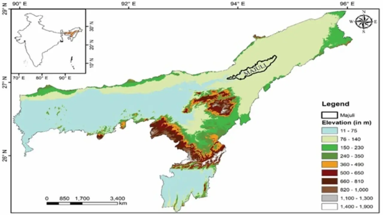
Majuli occupies a unique geographical position between the Brahmaputra River and its tributaries and is internationally recognised for its cultural and religious significance. Home to several indigenous communities and a major centre of Neo-Vaishnavite culture, the island has also faced decades of severe flooding, riverbank erosion and land loss.
Despite its importance, researchers noted that Majuli lacked a comprehensive long-term palaeoecological reconstruction based on fossil pollen evidence. To address this gap, scientists undertook a pioneering study combining pollen analysis and grain-size examination of sediment deposits to reconstruct the island's environmental history.
The research team collected a 150-centimetre-deep sediment core from Sakali Wetland on Majuli Island. By analysing preserved pollen grains and sediment characteristics, scientists were able to reconstruct vegetation patterns, climatic conditions and river dynamics spanning approximately 4,000 years.
Pollen grains are considered among the most reliable indicators of past environmental conditions because they can remain preserved in sediments for thousands of years. The study integrated modern pollen records with fossil pollen evidence to build a detailed environmental timeline for the island.
The findings revealed that Majuli experienced an early warm and humid climatic phase between approximately 4,040 and 2,260 calibrated years before present. During this period, dense forest cover dominated the landscape, suggesting that the region remained relatively resilient even during the globally recognised 4.2-kiloyear climatic event, which brought widespread drought conditions to many parts of the world.
Researchers found that this stable phase was followed by periods of fluctuating monsoon intensity and changing flood regimes. Between roughly 1,100 and 500 years before present, the region experienced relatively moist climatic conditions corresponding to the Medieval Climatic Anomaly, a period characterised by warmer temperatures in several parts of the world.
The study also indicates that over the past 500 years, Majuli experienced declining temperatures and precipitation levels, consistent with the global Little Ice Age. During this period, scientists observed increased human influence on the landscape and a gradual expansion of scattered vegetation.
In addition to climate reconstruction, the study sheds new light on the role of the Brahmaputra and its associated river systems in shaping the island's ecology and geography.
Grain-size analysis revealed a transition from relatively low-energy river conditions to increasingly high-energy fluvial environments over time. According to researchers, this shift reflects growing hydrodynamic instability and changing river behaviour, factors that are directly linked to flooding, sediment transport and erosion processes.
These findings are particularly significant for a region where recurrent floods and riverbank erosion continue to threaten settlements, agricultural land and cultural heritage sites.
The study highlights how integrating pollen and sediment analyses can improve understanding of past flood intensity, river dynamics and environmental change. Such information can serve as a valuable scientific resource for policymakers, planners and disaster management agencies working on flood mitigation and river management strategies in Northeast India.
Researchers noted that the environmental record demonstrates a clear relationship between local ecological changes and major global climatic events, underlining the sensitivity of the Upper Brahmaputra Valley to broader climate fluctuations.
The study also identifies periods of ecological resilience as well as vulnerability, offering lessons that may prove useful in addressing present-day climate challenges.
Scientists believe the findings can support biodiversity conservation initiatives, wetland restoration programmes and sustainable land-use planning efforts in Majuli and other riverine ecosystems facing similar environmental pressures.
The research was led by Arya Pandey, a DST-INSPIRE Senior Research Fellow, and Dr. Swati Tripathi, Scientist-E at BSIP. The study involved collaboration with Dr. Sadhan Kumar Basumatary, Dr. Salman Khan of Germany, Dr. Hema Singh of Banaras Hindu University, Dr. Biswajeet Thakur and Dr. Anupam Sharma.
Published in the international journal Review of Palaeobotany and Palynology, the study represents the first comprehensive multi-proxy reconstruction of climate, vegetation and river processes on Majuli Island.
Researchers say the findings could contribute significantly to future policymaking, climate adaptation planning and environmental security strategies aimed at protecting communities affected by recurring floods, erosion and land degradation in the Brahmaputra Valley.