An in-depth analysis of the July 2026 Assam floods examines changing rainfall patterns, riverbank erosion, infrastructure failures, Kaziranga's ecological challenges, and the policy reforms needed for long-term resilience.
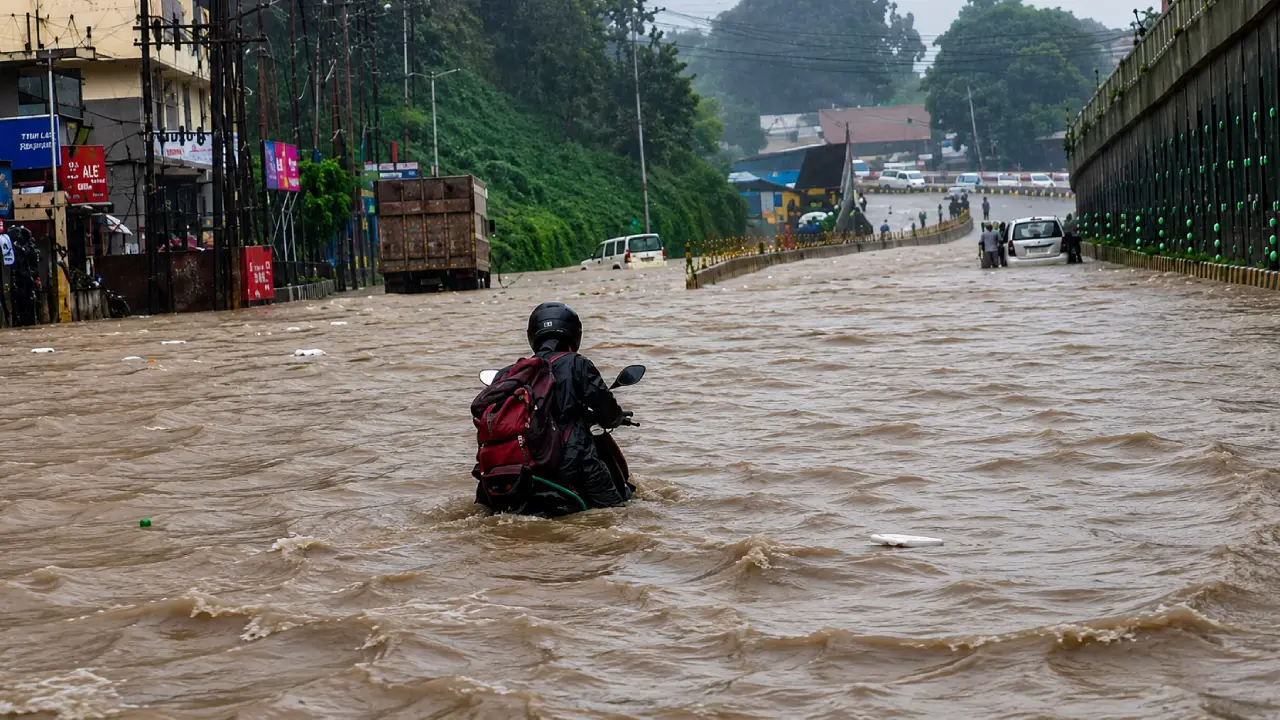
Guwahati, July 13: The July 2026 floods in Assam once again brought widespread inundation, damaged public infrastructure, displaced thousands of residents and disrupted livelihoods across several districts. Yet the unfolding crisis also reinforced an uncomfortable reality that has been taking shape over the past decade: Assam's flood challenge is no longer defined simply by rising rivers during the monsoon. Instead, it has evolved into a complex interaction between climate variability, permanent riverbank erosion, ageing infrastructure, ecological pressures, land-use conflicts and regional connectivity.
Floods have always been part of Assam's geography. The Brahmaputra and Barak river systems sustain agriculture, replenish wetlands and support one of the world's richest floodplain ecosystems. However, the frequency of extreme rainfall events, changing hydrological patterns and growing pressure on infrastructure are altering both the scale and nature of disasters. While emergency response has improved considerably over the years, the July 2026 floods demonstrate that disaster management alone cannot solve problems that are increasingly structural and long-term.
Flood conditions continue to affect several districts of #Assam, while urban flooding has caused disruptions in Kamrup and Kamrup Metropolitan districts.
— All India Radio News (@airnewsalerts) July 13, 2026
India Meteorological Department has forecast heavy rainfall in several districts of the state over the next couple of days.… pic.twitter.com/KkzKGTI7fs
Interestingly, the floods occurred during a period when India as a whole had not recorded exceptionally high seasonal rainfall. National cumulative southwest monsoon rainfall remained below the Long Period Average during the early weeks of the season.
The Northeast, however, experienced an entirely different weather pattern. Assam and neighbouring Arunachal Pradesh received concentrated spells of above-normal rainfall as multiple meteorological systems aligned simultaneously over the region. An active monsoon trough persisted across northeastern India while upper-air cyclonic circulations remained positioned over Assam. Continuous moisture transport from the Bay of Bengal further intensified atmospheric instability, producing repeated episodes of heavy to extremely heavy rainfall.
Recognising the seriousness of the situation, the India Meteorological Department (IMD) issued a Red Alert for Assam and Meghalaya on July 11 before gradually reducing the warning level to Orange and Yellow as weather conditions began stabilising.
The weather pattern reflects an emerging climate trend in India. Rather than widespread seasonal rainfall, many regions are increasingly witnessing concentrated bursts of intense precipitation over shorter periods. Such rainfall overwhelms drainage systems, rapidly raises river levels and leaves little time for communities to prepare.
Unlike many previous years, the July 2026 flood emergency did not unfold as a single event. The first wave began during the last week of June after heavy rainfall in Arunachal Pradesh and upper Assam caused rivers to swell. Districts including Dhemaji, Dibrugarh, Lakhimpur, Nalbari and Chirang experienced inundation, forcing thousands of people to leave their homes.
River systems such as the Disang crossed danger levels, while agricultural land, roads and rural infrastructure came under water.
A temporary improvement followed during the first week of July. Rainfall reduced, river levels receded and several districts began recovering. Relief camps started closing in some locations, crop damage appeared manageable and the overall flood situation seemed to be easing.
The respite proved deceptive. Fresh spells of heavy rainfall beginning on July 11 generated a second and more intense flood wave. Rivers quickly rose above danger marks once again, inundating villages across Dhemaji, Biswanath, Dibrugarh and Nalbari districts. Standing crops were submerged, livestock suffered significant losses and fresh evacuations became necessary.
The repeated rise and fall of floodwaters demonstrated how modern flood events increasingly occur in successive waves rather than as isolated incidents. Such cycles place enormous strain on disaster response agencies because recovery efforts often begin before another flood arrives.
The July floods exposed weaknesses that extend well beyond embankments. Damage assessments pointed to widespread disruption across transport networks, drinking water systems, irrigation infrastructure, power supply and educational institutions. Floodwaters entered public facilities while erosion undermined roads and bridges that serve as lifelines for remote communities.
One of the clearest examples was the partial collapse of the railway bridge across the Simen River in Dhemaji district. The bridge had served the region for decades. However, severe riverbank erosion washed away the supporting soil around one of its concrete piers, leaving the structure unstable. Northeast Frontier Railway suspended train operations along the Murkongselek-Silapathar section as a safety measure and arranged alternative transport for stranded passengers.
The incident highlighted a significant policy concern. Traditional flood management often focuses on water levels, whereas erosion silently weakens critical infrastructure long before visible structural failure occurs. Bridges, embankments, highways and railway lines across Assam increasingly face risks not only from floodwaters but from constantly shifting river channels.
Seasonal floods dominate headlines every monsoon, yet riverbank erosion may now represent the state's greatest long-term environmental challenge. Floodwaters eventually recede. Fields can often be cultivated again, damaged roads repaired and relief camps dismantled.
Erosion is fundamentally different. Once a river consumes land, that land rarely returns. Entire villages disappear. Schools collapse into rivers. Agricultural holdings accumulated over generations are permanently lost. Families become internally displaced, often relocating several times as riverbanks continue shifting. This permanent nature of erosion distinguishes it from seasonal flooding.
The cumulative loss of productive land also creates social and economic consequences that extend far beyond immediate disaster relief. Displaced households frequently lose legal ownership records, access to agricultural income and long-established community networks.
The challenge has become so significant that civil society organisations have intensified demands for Assam's flood and erosion crisis to receive recognition deserving of sustained national attention, arguing that temporary embankment repairs cannot address an environmental problem that permanently reshapes the state's geography.
Climate scientists increasingly caution that the Brahmaputra basin is becoming more vulnerable to extreme hydrological events. Higher atmospheric temperatures enable the atmosphere to retain greater quantities of moisture. When weather systems become favourable, this moisture is released through short-duration but extremely intense rainfall.
Such rainfall generates enormous runoff within a limited period. The Brahmaputra basin amplifies this process because rivers descend rapidly from the Himalayas before spreading across Assam's low-lying floodplains.
As runoff accelerates, rivers carry greater sediment loads, erode banks more aggressively and frequently alter their channels. Infrastructure built decades ago under different climatic conditions now faces stresses that were rarely anticipated during original construction.
This changing hydrology means future flood management cannot rely solely on historical flood records. Planning must increasingly account for climate uncertainty.
Floods are often viewed only as disasters, but they also sustain Assam's globally significant ecosystems. Kaziranga National Park depends on annual flooding to maintain its ecological health. Floodwaters deposit nutrient-rich sediments, replenish wetlands and support the grasslands that sustain rhinoceroses, elephants, wild buffaloes and numerous other species.
However, excessive flooding creates new conservation challenges. As water levels rise rapidly, wildlife naturally migrates towards the Karbi Anglong hills. Expanding road networks and human settlements increasingly interrupt these traditional migration routes, exposing animals to vehicle collisions and illegal hunting.
To improve wildlife protection, the Assam Forest Department introduced artificial intelligence-assisted flood monitoring during the 2026 monsoon season.
Satellite imagery, hydrological modelling, automated traffic surveillance and thermal monitoring systems are now being integrated to provide early warnings, regulate traffic near wildlife corridors and improve field-level response.
Technology can undoubtedly strengthen conservation efforts. Nevertheless, conservation experts continue to emphasise that preserving natural migration corridors remains equally important because engineered solutions cannot entirely replace functioning ecosystems.
The July floods also demonstrated how disasters in Assam increasingly affect neighbouring states. Heavy rainfall in Arunachal Pradesh, combined with controlled water releases from upstream reservoirs, contributed to downstream flooding in Lakhimpur district, renewing calls for stronger interstate coordination on reservoir operations and advance warning systems.
At the same time, heavy rainfall triggered landslides along National Highway-37 in neighbouring Manipur. The highway has become the state's principal supply corridor amid continuing disruptions on National Highway-2. Landslides slowed freight movement, stranded commercial vehicles and increased transportation costs across the region.
This interconnected reality highlights an important policy lesson. Infrastructure resilience can no longer be planned only within state boundaries. Roads, rivers, reservoirs and supply chains increasingly function as regional systems, meaning failures in one state can rapidly generate humanitarian and economic consequences elsewhere.
The recurring cycle of floods suggests that Assam must gradually transition from reactive disaster management towards long-term climate resilience. Several priorities emerge.
River basin management needs greater emphasis through scientific dredging where appropriate, desiltation of vulnerable tributaries and restoration of wetlands capable of naturally storing excess water.
Riverbank stabilisation should increasingly utilise modern engineering solutions such as geo-tube technology alongside ecological restoration. Ageing embankments require systematic strengthening before each monsoon rather than emergency repairs after breaches occur.
Infrastructure planning must incorporate future climate scenarios instead of relying solely on historical rainfall data. Equally important is the development of comprehensive rehabilitation policies for erosion-displaced families whose losses extend far beyond seasonal crop damage.
Assam's annual floods have long been viewed as an unavoidable consequence of geography. The events of July 2026 suggest the challenge has evolved into something much broader.
Climate variability is producing increasingly concentrated rainfall. Riverbank erosion continues to erase land permanently. Infrastructure built for an earlier climate is facing unprecedented stress. Wildlife habitats are becoming fragmented, while regional transport networks remain vulnerable to cascading disruptions.
Emergency relief will always remain essential during disasters. But the long-term answer lies in strengthening resilience before rivers overflow.
That requires integrating hydrological science, climate adaptation, ecological conservation, resilient infrastructure and coordinated regional planning into a single strategy rather than treating floods, erosion, transport and environmental protection as separate policy domains.
The July 2026 floods serve as another reminder that Assam's future will depend not only on how effectively it responds to disasters, but also on how successfully it prepares for a changing climate that is steadily reshaping both its rivers and its landscape.