A Chandel study finds major differences in soil acidity, organic carbon and nutrients across forests, jhum, fallows, grasslands and paddy lands, raising concerns over hill soil health.
Chandel, Manipur: A study of soils under five major land-use systems in Chandel district has found marked differences in acidity, organic carbon and the availability of nitrogen, phosphorus and potassium, with forest soils generally retaining higher organic matter and nutrient reserves than cultivated and fallow lands.
Published in the Journal of Advances in Biology & Biotechnology, the study by Hrangbung Jurist Anal, A. K. Singh, Chingangbam Karuna Chanu, Devarishi Laimayum, D. Saya and Osin Mengu examined soil conditions in natural forests, grasslands, paddy lowlands, active shifting cultivation or jhum fields, and jhum fallows.
The researchers collected 210 composite soil samples from Chandel, Chakpikarong and Khengjoi blocks between January and March 2023. Samples were taken from two depths, 0–15 cm and 15–30 cm, to examine how land use affected both surface and sub-surface soil.
The findings show that Chandel's hill soils are broadly acidic, while available phosphorus and, in several land-use systems, nitrogen remain low. Forest soils recorded the highest surface organic carbon, nitrogen and phosphorus, whereas active jhum produced the highest available potassium, a pattern the researchers associated with ash produced during biomass burning.
Five land-use systems compared
The study covered 21 locations under each of the five land-use categories. At every location, 10 soil sub-samples were collected and combined into one composite sample. This produced 105 surface and 105 sub-surface samples.
The researchers analysed soil pH, electrical conductivity, soil organic carbon and available nitrogen, phosphorus and potassium. Statistical comparisons were made using one-way ANOVA followed by Duncan's Multiple Range Test at a significance level of p<0.05.
The five land-use categories represented contrasting ecological conditions.
Natural forest represented relatively undisturbed forest cover. Grassland represented open, uncultivated areas, while paddy lowlands represented wet rice cultivation. Current jhum represented land under active shifting cultivation, while jhum fallow represented previously cultivated land undergoing natural regeneration.
The differences between these systems were particularly clear in the soil's organic carbon and nutrient content.
Acidic soils dominate across Chandel
All five land-use systems recorded acidic soil conditions.
Surface pH ranged from 4.71 in forest soil to 5.34 in paddy lowland soil. At 15–30 cm, the range was 4.83 to 5.40. The overall mean pH increased from 5.06 in surface soil to 5.17 in the sub-surface.
Natural forest recorded the lowest pH, at 4.71 in the surface layer and 4.83 in the sub-surface. Grassland recorded 4.93 and 5.03 respectively.
Current jhum had a surface pH of 5.20, while jhum fallow recorded 5.15. Paddy lowland soils were the least acidic among the five systems, with pH values of 5.34 at the surface and 5.40 at depth.
The researchers attributed the acidic conditions partly to the characteristics of humid hill environments, where rainfall contributes to the leaching of basic cations. Organic matter decomposition can also contribute to acidity in forest soils.
The consistently higher pH in the deeper layer was another feature observed across the land-use systems.
No salinity hazard found
Electrical conductivity, an indicator of the concentration of soluble salts in soil, remained low throughout the study area.
Surface EC ranged from 0.08 to 0.21 dS m?¹, while sub-surface values ranged from 0.07 to 0.18 dS m?¹. The overall means were 0.14 and 0.12 dS m?¹ respectively.
Paddy lowland recorded the highest EC, at 0.21 dS m?¹ in the surface soil and 0.18 dS m?¹ in the sub-surface. Current jhum recorded 0.16 and 0.14 dS m?¹, while jhum fallow recorded 0.12 and 0.11 dS m?¹.
Forest soil had the lowest EC, at 0.08 dS m?¹ in the surface and 0.07 dS m?¹ in the sub-surface.
The results indicate that salinity was not a major soil constraint in the areas covered by the study. EC generally declined with increasing soil depth.
Forest soils retain more organic carbon
One of the clearest differences emerged in soil organic carbon.
Surface organic carbon ranged from 12.46 to 18.43 g kg?¹, while sub-surface concentrations ranged from 9.59 to 14.14 g kg?¹.
Natural forest recorded the highest value, with 18.43 g kg?¹ in the surface layer and 14.14 g kg?¹ below it. Grassland followed with 15.90 g kg?¹ at the surface and 11.78 g kg?¹ at depth.
Current jhum recorded 15.21 g kg?¹ in surface soil and 12.25 g kg?¹ in sub-surface soil.
Jhum fallow had the lowest surface organic carbon among the five systems, at 12.46 g kg?¹, while paddy lowland recorded the lowest sub-surface value, at 9.59 g kg?¹.
The researchers linked the higher carbon levels in forest soils to continuous inputs from leaf litter and other plant material. Grasslands also receive substantial organic matter through root growth and turnover.
Across the systems, organic carbon was higher in the surface layer than in the sub-surface, reflecting the concentration of plant residues and biological activity near the soil surface.
Surface soil organic carbon by land use
Treatment means reported in the study for the 0–15 cm soil layer.
|
Land Use |
Soc |
|
Forest |
18.43 |
|
Grassland |
15.9 |
|
Current Jhum |
15.21 |
|
Paddy Lowland |
13.23 |
|
Jhum Fallow |
12.46 |
Values are g kg?¹.
Nitrogen remains low in most systems
Available nitrogen was another important constraint identified by the research.
Surface nitrogen ranged from 168.19 to 251.11 kg ha?¹, compared with 149.92 to 212.71 kg ha?¹ in the sub-surface. The overall means were 201.88 and 177.55 kg ha?¹.
Forest soil recorded the highest available nitrogen, at 251.11 kg ha?¹ in the surface layer and 212.71 kg ha?¹ in the sub-surface. Grassland followed with 210.03 and 187.19 kg ha?¹.
Current jhum recorded 193.93 kg ha?¹ at the surface, while jhum fallow recorded 186.13 kg ha?¹. Paddy lowland had the lowest concentration, at 168.19 kg ha?¹.
The study associated the generally low nitrogen status with climatic conditions that can limit microbial activity and nitrogen mineralisation. Crop removal and nutrient losses can further reduce available nitrogen in cultivated systems.
As with organic carbon, available nitrogen declined with soil depth.
Phosphorus emerges as a widespread constraint
Available phosphorus was low across all five land-use systems.
Surface concentrations ranged from 10.99 to 18.91 kg ha?¹, while sub-surface concentrations ranged from 7.94 to 14.44 kg ha?¹.
Forest soil recorded the highest available phosphorus, at 18.91 kg ha?¹ in the surface layer and 14.44 kg ha?¹ in the sub-surface. Grassland recorded 16.02 and 11.65 kg ha?¹.
Paddy lowland and jhum fallow had similar surface values, at 13.69 and 13.95 kg ha?¹ respectively.
The lowest phosphorus concentration was found in current jhum, at 10.99 kg ha?¹ in surface soil and 7.94 kg ha?¹ at depth.
The researchers linked the low phosphorus availability to the acidic nature of the soils. Under strongly acidic conditions, phosphorus can become fixed by iron and aluminium compounds, reducing the amount available for plant uptake.
Phosphorus also showed a decline with depth in all land-use systems.
Jhum produces a temporary potassium increase
Potassium displayed a different pattern from nitrogen and phosphorus.
Available potassium in surface soil ranged from 141.72 to 232.32 kg ha?¹. In sub-surface soil, it ranged from 137.20 to 225.92 kg ha?¹.
Current jhum recorded the highest potassium concentration, with 232.32 kg ha?¹ at the surface and 225.92 kg ha?¹ in the sub-surface.
Forest soil followed with 203.33 and 189.22 kg ha?¹. Paddy lowland recorded 167.95 kg ha?¹ at the surface, while grassland recorded 164.86 kg ha?¹.
Jhum fallow had the lowest potassium concentration, at 141.72 kg ha?¹ in the surface layer and 137.20 kg ha?¹ below.
The researchers associated the high potassium concentration in active jhum with ash generated when vegetation is burned. Potassium contained in plant biomass can be released through burning and temporarily increase its availability in the soil.
The much lower concentration in jhum fallow illustrates the temporary nature of this increase. Rainfall and erosion can remove soluble nutrients from exposed hill soils, particularly after cultivation and before sufficient vegetation is re-established.
Surface soil nutrients by land use
Available nitrogen, phosphorus and potassium in the 0–15 cm layer.
|
Land Use |
Nitrogen |
Phosphorus |
Potassium |
|
Forest |
251.11 |
18.91 |
203.33 |
|
Grassland |
210.03 |
16.02 |
164.86 |
|
Paddy Lowland |
168.19 |
13.69 |
167.95 |
|
Current Jhum |
193.93 |
10.99 |
232.32 |
|
Jhum Fallow |
186.13 |
13.95 |
141.72 |
Values are kg ha?¹; nutrient scales differ substantially.
What the findings mean for shortened jhum cycles
The results are particularly relevant to the changing pattern of shifting cultivation in the hills.
The study notes that traditional shifting cultivation depended on relatively long fallow periods that allowed vegetation and soil nutrients to recover. The source material contrasts historical fallows of roughly 20–30 years with contemporary cycles that can be reduced to around two or three years under growing land pressure.
A shortened fallow does not provide the same period for forest biomass, organic matter and nutrient pools to recover.
The soil data illustrates this problem. Active jhum had the highest potassium concentration because of the immediate effect of ash deposition. But jhum fallow, after that temporary nutrient pulse, had the lowest potassium concentration among the five systems.
The difference in organic carbon is also significant. Forest surface soil contained 18.43 g kg?¹ of organic carbon, compared with 12.46 g kg?¹ in jhum fallow.
These figures do not by themselves establish a direct cause-and-effect relationship between a particular fallow length and soil degradation across all of Manipur. The study was restricted to selected locations in Chandel district and was based on sampling conducted during one period in 2023. However, the findings provide a measured comparison of soil conditions under different land-use systems in the district.
Soil conservation needs to account for hill conditions
The researchers' findings point to several areas for soil management.
Acidic soils require careful nutrient management, particularly where phosphorus availability is low. Liming materials can be considered where soil tests establish a need for acidity correction, while organic amendments may help improve soil structure and nutrient cycling.
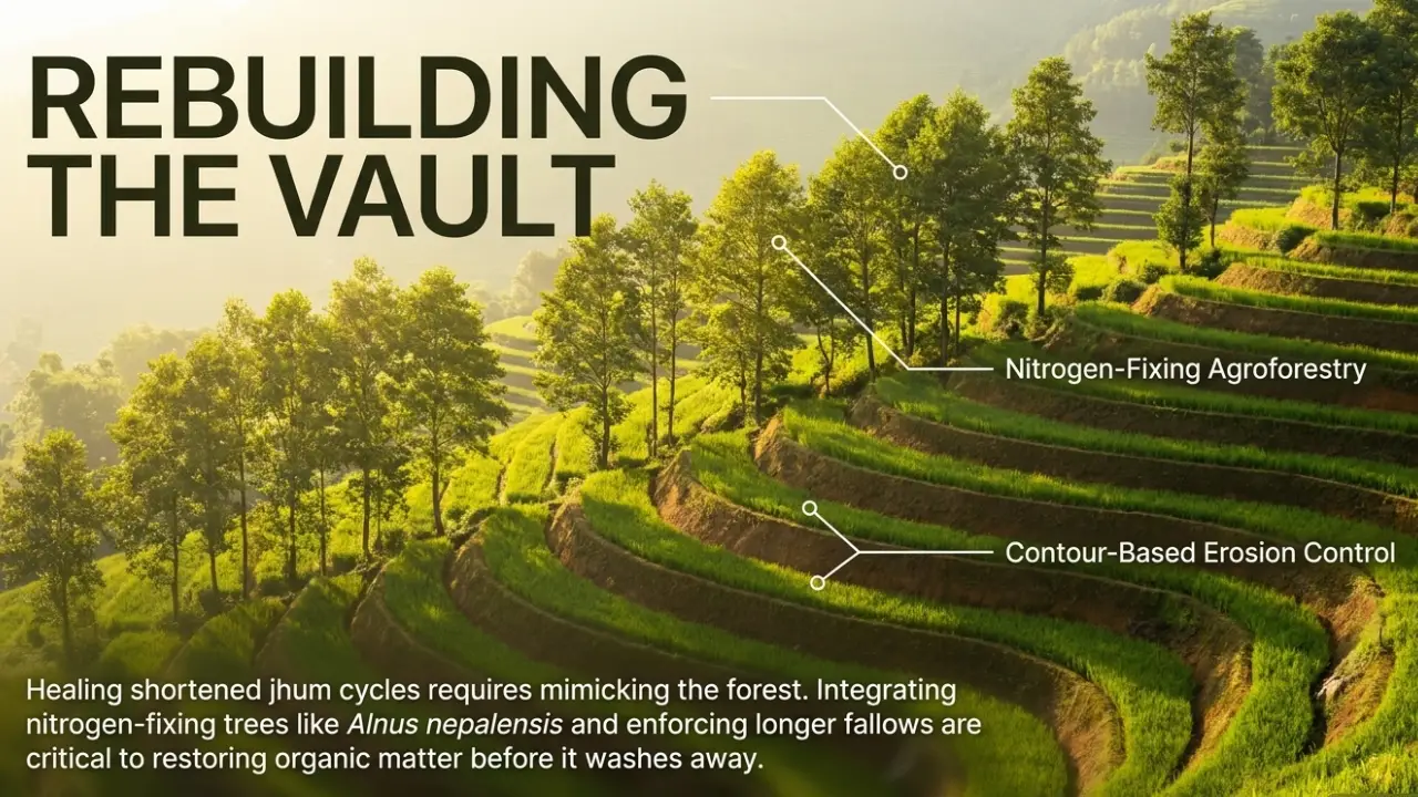
The study also points to the importance of erosion control in cultivated hill areas. Maintaining vegetation cover, using contour-based measures and incorporating agroforestry approaches can help reduce the exposure of sloping soils to intense rainfall.
For jhum areas, agroforestry and longer fallow periods where feasible could help maintain vegetation and organic matter. Nitrogen-fixing tree species such as Alnus nepalensis are among the options identified in the study's recommendations.
Paddy lowlands present a different set of concerns. Despite having the highest pH and EC among the systems examined, they recorded the lowest available nitrogen and the lowest sub-surface organic carbon. Integrated nutrient management, including appropriate organic inputs and careful fertiliser application, could therefore be relevant to maintaining soil fertility.
A baseline, not a complete soil assessment
The researchers caution through the scope of their methodology that the findings should be interpreted within the boundaries of the study.
Sampling was limited to Chandel, Chakpikarong and Khengjoi blocks. Only two soil depths were examined, and field sampling took place between January and March 2023.
The study focused on six indicators, pH, EC, organic carbon, available nitrogen, phosphorus and potassium. It did not provide a complete assessment of soil physical properties, micronutrients, soil biology or long-term changes in soil fertility.
Even with these limitations, the study establishes a useful comparative baseline. Its central finding is that land-use systems in Chandel are associated with distinctly different soil chemical profiles.
Forest soils retained the highest organic carbon, nitrogen and phosphorus levels, while active jhum showed a pronounced potassium increase associated with burning. Jhum fallow, meanwhile, recorded low potassium and organic carbon levels. Paddy lowlands had relatively higher pH but low nitrogen and sub-surface organic carbon.
For Manipur's hill agriculture, the findings underline the importance of viewing soil fertility not simply as a question of fertiliser application, but as part of a wider relationship between vegetation, cultivation, fallow periods, rainfall, erosion and nutrient cycling.