Manipur Forest Department has issued a detailed forest fire SOP covering village committees, satellite alerts, rapid response teams, ecological risks, equipment audits and legal action.
Imphal, Oct. 6: The Manipur Forest Department has ordered a statewide strengthening of forest-fire prevention, surveillance and response measures, directing territorial forest divisions to activate village-level fire committees, establish temporary fire-watching camps and ensure frontline personnel receive real-time satellite-based alerts during the fire season.
The directions were issued by Principal Chief Conservator of Forests and Head of Forest Force Anurag Bajpai in an Office Memorandum dated October 5. The department cited the continuing damage caused by forest fires to ecosystems, natural regeneration, young plantations, wildlife and watersheds, and warned that the situation could worsen amid the shortage of rainfall this year and the impact of El Nino.
The new Standard Operating Procedure (SOP) places particular emphasis on community-level preparedness. Territorial Divisional Forest Officers (DFOs) and Range Forest Officers (RFOs) have been directed to immediately notify and activate Village Forest Fire Committees (VFFCs) in coordination with Village Authorities, Joint Forest Management Committees (JFMCs) and local youth clubs.
The objective is to create a grassroots network capable of maintaining continuous surveillance and responding quickly when fires are detected.
Forest officials have also been instructed to conduct intensive awareness campaigns across both hill and valley areas. Beat and Range personnel, working with local administrations, are to use mobile public-address systems in vulnerable fringe villages, market areas and traditional gathering points to educate residents about fire hazards, statutory prohibitions and the fire season.
Satellite alerts to be expanded to forest-fringe communities
Another key component of the SOP is mandatory registration on the Forest Survey of India’s Van Agni Geo-portal.
The department has directed field officers to ensure 100 per cent registration of frontline forest staff, VFFCs, JFMC executives, local volunteers, youth groups and active environmental organisations so they can receive satellite-based forest-fire SMS alerts.
The memorandum specifically directs officials to ensure that registration is not concentrated only at divisional headquarters but is spread among people living in forest-fringe areas.
The Van Agni system provides satellite-based detection of forest fires, making timely local verification and response an important part of the warning chain. The department’s new instructions seek to widen that chain beyond government personnel to community-level responders.
Fire camps and equipment audit ordered
The SOP calls for temporary fire camps and observation posts to be established immediately in highly vulnerable and fire-prone forest blocks and younger plantations.
Dedicated patrol squads are to maintain round-the-clock watch during the fire season.
The department has also directed every Division, Range and Beat office to display weatherproof emergency contact boards at prominent public locations. These boards must carry 24-hour Forest Fire Emergency Control Room numbers as well as the mobile contact details of the concerned DFO, RFO, Beat Officer, local police station and Fire Services.
DFOs have additionally been told to ensure that radio handheld devices are functional and that messages received from the Forest Headquarters Control Room are responded to promptly.
A physical audit and inventory of firefighting equipment has been given a seven-day deadline. Fire beaters, water backpacks, blowers, protective equipment, wireless sets and transport vehicles are among the equipment to be checked.
Defective equipment must be repaired or replaced on priority to ensure operational readiness.
Rapid response teams to operate at three levels
The Forest Department has ordered Rapid Response Firefighting Teams to be operationalised at the divisional, range and beat levels.
These teams are to be properly trained and integrated with local VFFCs and JFMC volunteers.
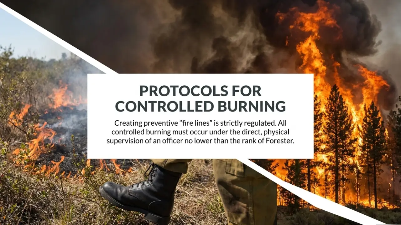
The SOP also regulates controlled burning used for creating fire lines. Such burning must follow prescribed protocols and take place under the direct supervision of an officer not below the rank of Forester.
Regular mock drills are also to be conducted in vulnerable areas with assistance from the State Disaster Response Force and local Fire Department.
The department has warned that any dereliction of duty, negligence in maintaining vigil or delay in mobilising response teams will be viewed seriously and may lead to disciplinary proceedings.
Forest-fire risk remains high across Manipur
The new SOP comes against a broader wildfire risk profile in Manipur, where forest fires recur during the annual dry season and are linked to human ignition sources, seasonal dryness and the state’s difficult mountain terrain.
Assessments by NE Dispatch indicate that large portions of Manipur’s forest landscape fall within highly fire-prone categories. Fire activity is particularly concentrated in several hill districts, including Churachandpur, Tamenglong, Ukhrul, Kangpokpi and Tengnoupal.
The combination of steep slopes, dry vegetation, shifting cultivation and limited access to remote forest areas can make fires difficult to contain once they spread.
The background assessment also identifies shifting cultivation, or jhum, as a major source of forest-fire ignition. Burning associated with field preparation can spread when fire lines are poorly maintained or when dry vegetation and weather conditions favour rapid propagation.
Other ignition sources identified include fires associated with hunting, grazing and land clearing, as well as accidental fires around forest fringes and settlements.
Sensitive habitats face repeated fire pressure
Repeated forest fires pose particular risks to Manipur’s montane ecosystems and biodiversity.
The Shirui Hills in Ukhrul district, the natural habitat of the endemic Shirui Lily, have experienced repeated fires. High-intensity burning can damage surface vegetation and soil layers and affect natural regeneration.
The Dzukou Valley along the Manipur-Nagaland boundary has also experienced large wildfire events. Its high-elevation grasslands and specialised habitats are vulnerable to vegetation loss and soil erosion following severe fires.
The impact extends beyond biodiversity. Repeated burning in catchment areas can remove protective vegetation, increase soil erosion and affect watershed functions.
The Langol forest landscape near the Imphal Valley, for example, serves as an important environmental buffer and catchment. Fires in such areas therefore have implications not only for forests but also for surrounding communities and water systems.
Early detection and local response remain critical
Manipur already benefits from satellite-based fire detection through the Forest Survey of India’s monitoring network.
The Van Agni system uses satellite observations to identify thermal anomalies and distribute alerts to registered forest officials. The October 5 SOP seeks to strengthen the ground-level component by expanding registration to local volunteers, community groups and people living near forest fringes.
This is particularly important in remote hill areas where access by road can be difficult and where a fire can spread substantially before outside response teams reach the site.
Early detection, therefore, can reduce the time between a satellite alert and physical verification or initial suppression.
The Forest Department’s emphasis on VFFCs, JFMCs and youth groups also places greater responsibility on local institutions that can potentially respond before a fire develops into a larger incident requiring specialised intervention.
Enforcement against deliberate fires
Alongside prevention and preparedness, the SOP directs field officials to take legal action against deliberate forest burning.
The department has instructed officials to book miscreants and perpetrators under relevant provisions of the Indian Forest Act, 1927, the Wildlife (Protection) Act, 1972 and the Bharatiya Nyaya Sanhita, 2023.
Prompt filing of First Information Reports and close coordination with district police authorities have been made mandatory.
The order also requires DFOs to assess forest-floor fuel loads and submit mapped assessments identifying areas with high, medium and low fuel loads.
Renewed forest-fire susceptibility maps are to be prepared and submitted by all DFOs, including the Wildlife Division.
Preparedness ahead of the dry season
The October 5 memorandum combines community participation, satellite-based early warning, field surveillance, equipment readiness, rapid response, enforcement and mock drills.
Its implementation will depend on how quickly the Forest Department can activate village committees, establish observation posts, complete equipment audits and ensure that satellite alerts reach people capable of responding at the local level.
The wider wildfire risk in Manipur is shaped by a combination of human ignition, dry-season conditions, vegetation and difficult terrain. The department’s new SOP seeks to address these risks before fires escalate, while making clear that failures in maintaining preparedness and response readiness will attract official scrutiny.